Restrooms located in State Parks and at these campgrounds allow free access to the restrooms with a limited time to use the facilities. I've added the gas station locations as a public service because of the limited gas available in Big Sur.
Mile markers run from south to north from county lines. So, Carmel River State Beach is 71 miles north of the Monterey County Line. Hearst Castle is located 57.8 miles north of the southern border of San Luis Obispo County line.
Big Sur Chamber of Commerce - http://www.bigsurcalifornia.org (831) 667-2100
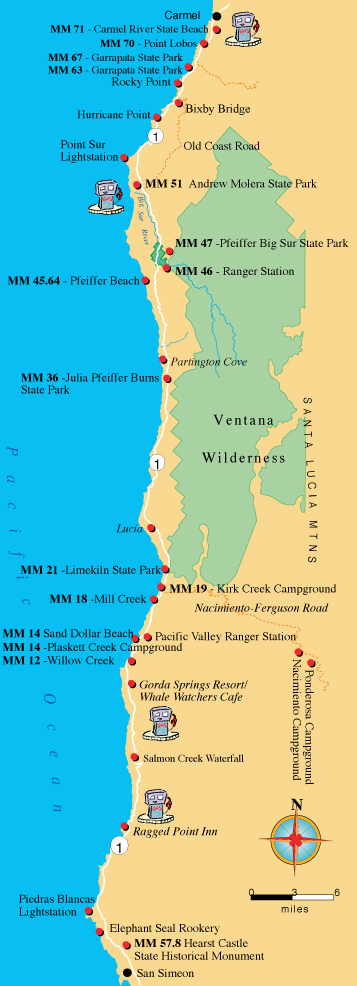 Restrooms located in State Parks and at these campgrounds allow free access to the restrooms with a limited time to use the facilities. I've added the gas station locations as a public service because of the limited gas available in Big Sur.